JMHumphreys
John Humphreys
Recently Published

Grasshoppers and ENSO
This script provides code that demonstrates the general workflow and modeling framework used for analysis in the publication:
Humphreys JM, Srygley RB, Lawton D, Hudson A, and Branson DH, 2022. Grasshoppers Exhibit Asynchrony and Spatial Non-Stationarity in Response to the El Nino/Southern and Pacific Decadal Oscillations (in review)
For data and code to run this analysis, please see the project Open Science Framework website: https://osf.io/dmyhf/
Example Code: Grasshopper Recruitment
Code showing analysis of grasshopper recruitment under preferential sampling and density dependence. Code and data: https://osf.io/ny4b5/
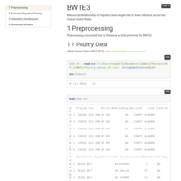
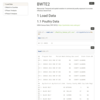
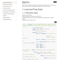
Waterfowl to Poultry AI Interface Model
This code serves as an example of models and analyses developed to better understand spatial and temporal trends in the risk of avian influenza transmission between wild waterfowl and domestic poultry. This study is in early stages and should be considered preliminary and exploratory only.
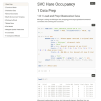
SVC Hare
Hare SVC Nov 21, 2019.
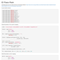
El Paso Rain
Example using the Global Historical Climatology to get rain data.
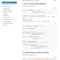
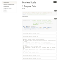
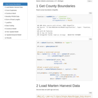
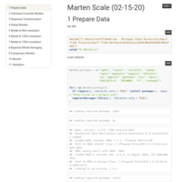
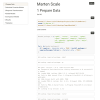
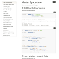
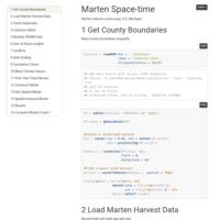
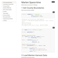
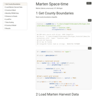
Marten Harvest Project 2
After removing the year 2000.

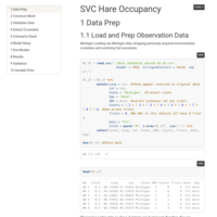
Hare Occupancy 7B
Addition of MI vs. WI.

BWTE Movement and Behavior
Movement analyses are applied to evaluate the relationship of blue-winged teal (BWTE) behavioral states and migration timing to avian influenza (AI) surveillance and documented outbreaks. BWTE land cover associations and proximity to commercial poultry abundance are also assessed.
Commercial poultry exposure to an avian influenza natural host
A spatial-temporal model is used to estimate timing of reservoir migration with each of four major flyways allowed to independently vary. Results are compared to commercial poultry abundance across the U.S. to assess Exposure of poultry to the AI host.
Joint spatial modeling of avian influenza and blue-winged teal
Accounting for outbreak clusters and potential reservoir movement in disease modeling: Joint spatial modeling of avian influenza and blue-winged teal.
Hare Occupancy 3
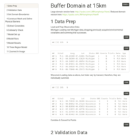
Buffer domain at 15km
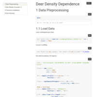
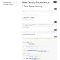
Deer Density Dependence
Influence of density dependence on body condition and fecundity.
Hare Occupancy 2
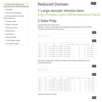
Reduced domain
Hare Occupancy 1
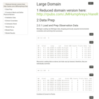
Large Domain
Hare Occupancy Redux 2
Joint Model for detection-occupancy with non-stationary spatial field and regionally varying environmental covariates.

Hare Occupancy Redux
Joint Model for detection-occupancy with non-stationary spatial field and regionally varying environmental covariates.
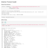
Snowshoe Hare Occupancy
Joint Model for detection-occupancy with non-stationary spatial field and regionally varying environmental covariates.
Deer Density Dependence
Density dependent body weight, body fat, and fecundity.
LGCP Example
Mallard ducks in South Carolina.
Deer Antler Diameter
Spatio-temporal modeling of 30 year deer antler diameter data using space-time interaction.
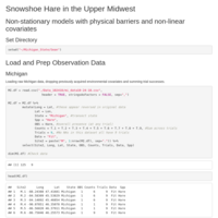
Non-stationary spatial fields
Non-stationary spatial fields with physical barriers.
Joint spatial modeling of avian influenza and blue-winged teal
Accounting for outbreak clusters and potential vector movement in disease modeling: Joint spatial modeling of avian influenza and blue-winged teal.
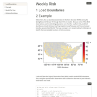
Poultry Risk Avian Influenza
Joint modeling of disease outbreaks and animal movement telemetry.
Site Metrics
Edge density for select locations and buffer distances.
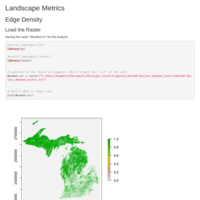
Edge Density Example
Edge Density Example

BWTE Argos Spatial Data
Cleaning spatial telemetry data
Cleaning Argos BWTE Telemetry Data
Function to perform a series of change-point analyses on telemetry data.
Dune Vegetation Dynamics
A Bayesian approach to spatial-temporal multi-species joint model for vegetation dynamics.
Coregionalization Model for Geographic Distributions
Joint-modeling of environmental, morphometric, and phylogenetic data
Joint-modeling of environmental, morphometric, and phylogenetic data
Joint-modeling of environmental, morphometric, and phylogenetic data
Phyllotis Phylogeny: MrBayes and RAxML
Comparing Bayesian and Likelihood trees.
SDM Pre-processing
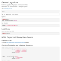
Data Pre-processing for Lygodium microphyllum SDM.
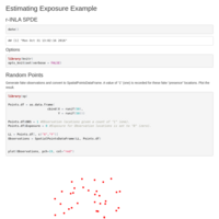
A Bayesian geostatistical approach to modelling global distributions of Lygodium microphyllum under projected climate warming.
SDM Model Fitting and Results
Lygodium microphyllum (Old World Climbing Fern). Global distribution using the r-INLA SPDE approach.
Phyllotis Phylogeny
Phyllotis Systematics
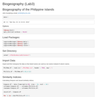
Compare mammal composition across Philippine Islands
Applying the Simpson and Jacard similarity indices to compare mammal composition across Philippine Islands.