
MRufino
Marta Rufino
Recently Published

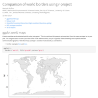
Handy maps for European marine areas
In this script we aim to explore different available datasets and tools for producing a EU marine areas maps. It does not intend to be exhaustive, but rather to make a sample script that I often (re)use and might be useful to others. From a short quick map to put in data to higher resolution maps, that may require downloading the data from the internet.
From these bases, we can than add our data or costumize the maps accordingly our taste and desires.

Mapping EU small scale fisheries
This is an exercise, to map small scale fisheries of the EU fleet by countries. Data was obtained from the EU fleet registry.
Gentle introduction to plots in R
This Rpub was done to make a soft introduction to r plotting to master students from International Master of Science in Marine Biological Resources (IMBRSea) - 2023 LEG3, and to give a couple of more sophisticated examples.
Do you want to know where you can go traveling by plane on your next holidays?
Country borders and bathymetry
n this script I will explore different packages and tools for producing a small country border (e.g. Portugal) and a local area detail (e.g. Ria de Aveiro or Ria Formosa). It does not intend to be exhaustive, but rather to make a sample script that I often (re)use and might be useful to others. From a short quick map to put in data to higher resolution maps, that may require downloading the data from the internet.
From these bases, we can than add our data or costumize the maps accordingly our taste and desires.
color_in_r
This small compilation explores some the different palettes in r, potentially useful, that I often forget.
Coastlines
This hopefully small script will go through different coastline files in r, with the aim of exploring the available ones, and see how these can be plotted within the sf framework.
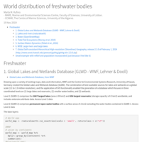
World freshwater
This doc compiles some of the available databases of freshwater (rivers, lakes, etc.) at a world wide scale.
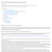
World distribution of estuaries
The aim of the current document is to get the best possible map with the world wide location of the estuaries, transition zones, bays, wetlands, etc. (i.e. inside areas with salinity gradients), with the respective boundaries (spatial polygons). For this, I will explore different datasets available in the internet and merge them into a global dataset. All these operations are done using r. Freshwater datasets were also briefly mentioned.
World Biogeographic Regions
The delineation of biogeographical regions has been one of the main focuses of naturalists, and later of ecologists. In this document, I briefly review and explore some of the previous propositions of biogeographical regions, both for terrestrial and marine ecosystems.