
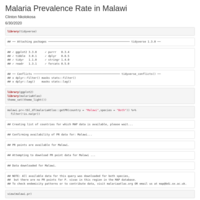
Clinty
Clinton Nkolokosa
Recently Published

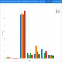
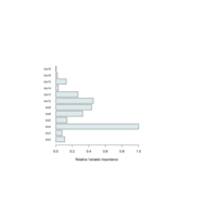
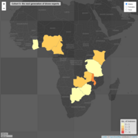
Decadal Land Use-Land Cover Change in Southern Malawi
Dashboard for exploring the dynamics of past (1990-2020) and future (2030) land use -land cover change (1990-2020) across southern Malawi.
Land Use-Land Cover Change Dynamics in Southern Malawi
Temporal changes in land use-land cover from 1990 to 2020 in southern Malawi
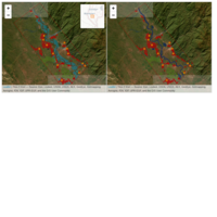
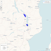
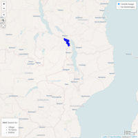
Post Flood and Pre Flood Situaion in Southern Malawi as of 30 January 2022
Riverine flood situation in Chikwawa after the passage of tropical storm named Ana on 25 January, 2022.
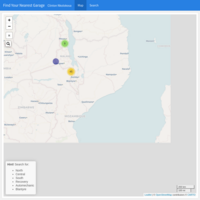
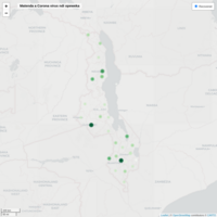
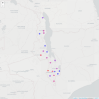
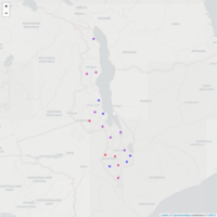
Find your nearest garage
Location of motor garages by district
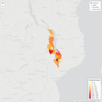
COVID-19 Map
COVID-19 situation in Malawi as of May 28, 2021
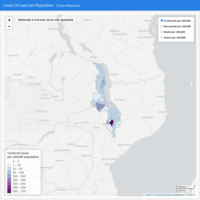
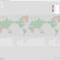
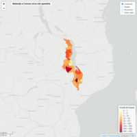
Covid-19 Cases per 100,000 Population
Rates per 100,000 population for Covid-19 confirmed, deaths, recovered and active cases have been used to calculate Covid-19 infection, mortality and recovery rate in districts of Malawi, using the 2018 population census from National Statistical Office. Multiplying the rate by 100,000 makes the rate comparable with districts with more than 100,000 or less than 100,000 people.
NB: A rate of 18 per 100,000 is not 18%, but 0.018%. To make a rate into a percent, for the example of 18 deaths per 100,000 population, divide by 1,000.

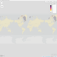
Geovisualization of Covid-19 Cases at National Level
Includes a bivariate choropleth map of Covid-19 infection and recovery rate using a 3x3 grid scale legend. The legend describes how each of the colored values combine to present information on whether the infection and recovery variables tend to be in agreement or disagreement. Dark blue, or the upper right corner, indicates that the values are both high and in agreement, and light blue, vice-versa.
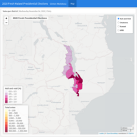
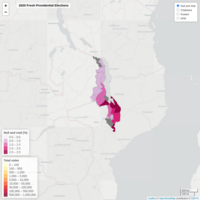
2020 Fresh Presidential Elections Results
Please note that the candidate figures were obtained from Zodiak Online, MIJ Online, MBC Malawi, Times 360 Malawi and Capital FM.
Districts with Covid-19 Confirmed Cases
Official data source: Public Health Institute of Malawi (PHIM), Ministry of Health, Malawi
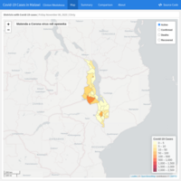
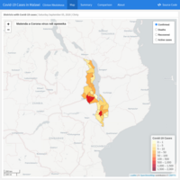
Covid-19 Cases in Malawi
Districts with Covid-19 confirmed, recovered, active and death cases in Malawi. Last updated: Tue Jun 30 2020 13:37 GMT +0200. Data source: Public Health Institute of Malawi (PHIM), Ministry of Health, Malawi
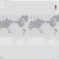
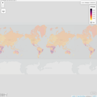
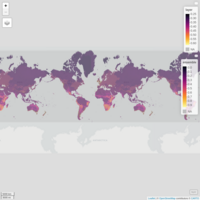
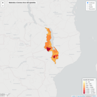
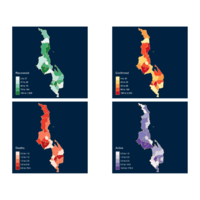
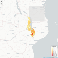
Malaria Prevalence Rate in Malawi
Prevalence of malaria in Malawi from 1990 to 2013. Data source: open-access malaria data, hosted by the Malaria Atlas Project.
Districts with Covid-19 Cases in Malawi
National Covid-19 cases as of 19 June 2020. Data source: Ministry of Health-MW Covid-19 National Information Dashboard https;//covid19.health.gov.mw
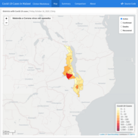
Covid-19 Cases in Malawi
Districts with confirmed cases. Last update: Mon Jun 08 2020 15:32 GMT +0200
Covid19 Cases for Malawi
Covid19 confirmed cases, deaths and recovered cases in districts of Malawi as of 05 June 2020. Data source: https://covid.health.gov.mw