
ErikReid
Erik Reid
Recently Published
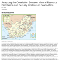
Analyzing the Correlation Between Mineral Resource Distribution and Security Incidents in South Africa
In the contemporary global landscape, mineral resources are critical to technological progress and economic development. Africa, rich in essential minerals like rare earth elements and precious metals such as cobalt and tantalum, is essential in supporting various critical industries. However, these resources are extracted and managed with security challenges, including conflicts, extortion, and bribery by armed groups. These issues compromise the operational stability of mining endeavors, pose significant risks to human safety, and disrupt global supply chains. This project seeks to identify the spatial distribution of crucial mineral resources across Africa alongside the patterns of security incidents within these regions. By integrating primary geospatial datasets from the United States Geological Survey (USGS) and the Armed Conflict Location & Event Data Project (ACLED), the project aims to illuminate the interactions between mineral resource management and security dynamics. The objectives of this study include mapping the spatial distributions of critical minerals and analyzing the temporal and spatial patterns of security incidents related to mining operations. This approach is intended to aid in formulating effective policies to enhance security and resource management, ultimately contributing to the stability and efficiency of mining operations in Africa. By mapping the distribution of minerals and security incidents, identifying clusters and trends, and exploring the correlation between mineral presence and security risks, the analysis aims to offer insights for risk assessment, strategic planning, and policy development. The findings are expected to offer valuable insights and actionable recommendations for policymakers, industry stakeholders, and security planners, fostering a more secure and prosperous future for mineral resource management on the continent. This project aligns with historical and contemporary research on the nexus between mineral wealth and conflict and positions itself at the forefront of applying Spatial Data Science to address these enduring challenges.

Missouri Population Education and Income Statistics
Missouri, located in the Midwestern United States, showcases a geographically and socioeconomically varied landscape. The state’s educational and income levels reflect its mix of urban and rural areas, with distinct differences between metropolitan regions like St. Louis and Kansas City and the more rural and agricultural parts of the state.
This report will use U.S. Census Bureau data to compare graduate-level education levels and median income levels for 2020. Because the U.S. Census data is comprehensive and contains millions of data tables, we will utilize the tidycensus R package for ease of data use. Additionally, we will showcase two types of data analysis: Non-spatial and Spatial data analysis.

Mapping of Tornados in Oklahoma
During this analysis, we will examine tornado activity in Oklahoma with a various geospatial data sets which cover 67 years of reporting. First, we will generate a map of tornado paths where the paths from each year are displayed as a different color, and create a composite figure containing the map of tornado paths and the map of tornado points. Next, we will summarize the density of tornado points by both county and year and generate a faceted plot that displays maps of county-level tornado density from 2016-2021.And finally, we will generate four choropleth maps of tornado density based on quantile breaks with numbers of classes ranging from 3 to 6, and create a composite figure containing the four maps to examine how the number of classes changes the interpretation of the map.

An Overview of Mining Facilities in Africa
This web map utilizes the leaflet package to create an interactive map showing the locations of mining facilities on the African continent. It will allow users to see not only where the facilities are located but also what resources they are extracting.

A Two-Part Analysis: Mapping of Tornados in Oklahoma and An Overview of Mining Facilities in Africa
This document consists of two major sections. First, we are going to analyze and visualize tornado activity within Oklahoma over a specified period of time. Through a combination of mapping and data visualization techniques, this project aims to provide insights into the patterns and density of tornado occurrences, their paths, and how these aspects vary across different regions and over time. In section two, this project will provide an overview of mineral mining facilities throughout the African continent with the use of an interactive map.

The Dynamics of Conflict in Somalia: An Analysis of ACLED Data
Somalia has faced various challenges over the years, including political instability, violence, and conflict. This analysis aims to explore the dynamics of these events using data from the Armed Conflict Location & Event Data Project (ACLED). By examining the data, we seek to uncover trends in conflict and violence, the distribution of events across different regions, and the actors most involved in these incidents.