
jslingsby
Jasper Slingsby
Recently Published
Ecohydrological clusters
Exploring the use of the National Vegetation Database to parameterise a coutrywide hydrological model.
NVD
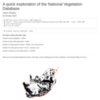
An exploration of the National Vegetation Database of South Africa
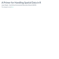
A Primer for Handling Spatial Data in R
Points, lines, polygons and rasters - R can handle them all. My aim for this session is to give you the basics required to teach yourself spatial data analysis in R. I'll start by briefly covering CRAN Task Views and how to install them (using the 'Spatial' task view as an example), followed by some pointers for useful DIY resources for handling and analyzing spatial data, and then work through a practical example exploring fire history layers (polygon), topographic (raster) and locality (point) data using the libraries 'rgdal', 'raster' and 'sp'. The example will cover setting and changing projections and extents, raster calculations, rasterizing polygons and extracting data with a few neat tricks along the way.