
markpayne
Mark R Payne
Recently Published

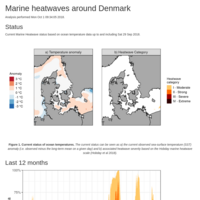
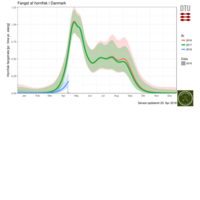
Denmark MHWs
Overview and status of Marine Heatwaves in waters around Denmark
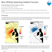
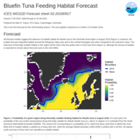
Blue Whiting Spawning Habitat Forecast
Details the forecast of the spatial distribution of Blue Whiting Spawning Habitat
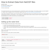
How to Extract Data from NetCDF files
Describes how to extract point-wise data from NetCDF files, using the HadISST dataset as an example
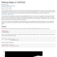
Making Maps with GGPlot2
Shows how to make oceanography-focused maps using GGPlot2 as the graphing engine
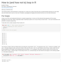
How to (and how not to) loop in R
This tutorial provides a brief introduction to using loops in R. It gives you an idea of how they work, and demonstrates that they are in fact really slow and should only be used as a last resort. Examples using lapply() and tapply() demonstrate that these are much better alternatives.
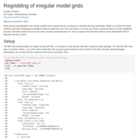
Regridding of irregular model grids
Many (most) oceanographic and climate models work on grids that are not based on standard lat-long coordinates. While it is common for these models to provide remapping and gridded outputs to make the user’s life a bit easier, it is not by any means unusual to have to do the regridding yourself. This demo shows how it can be done using the standard tools in R.
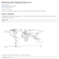
Working with Spatial Data in R
A quick overview of packages and tools in R that are useful for working with spatial, oceanographic and climate data.